

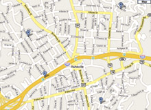
If you’ve seen a small sedan tooling around town with a 4-foot-tall pole strapped to its top, don’t be alarmed. The car, which has a camera mounted atop the pole, is part of Google Street View, which aims to give Internet users a street-level, panoramic vista of streets and neighborhoods.
Asheville resident Greg Goodman spotted the car recently, with its California license tags and “Google” sticker.
“I think it’s interesting that they would put AVL on their mapping list (assuming that is what they are doing),” he wrote in an e-mail response to Xpress’ questions. “I checked Google that night, and the only NC city with ‘street view’ is Raleigh. My son thought it was cool—anything Google is cool to him.”
Company spokesperson Elaine Filadelfo confirmed that Google is, in fact, mapping Asheville with camera-mounted cars. Durham and Chapel Hill also have Google Street View, she said, and the company is “trying to get to smaller regions [in North Carolina] as well.”
Once a mapping effort is launched, it takes about a year to get the content online, Filadelfo explained. It’s all designed to provide useful information for people traveling or planning trips, she added.
But not everyone likes the idea of having so much information available at the click of a mouse. Earlier this month, a Pennsylvania couple sued Google, claiming that photos of their home on Street View violate their privacy.
Filadelfo said the company takes privacy concerns seriously. “We only drive on public roads, and we have easy tools for users to request takedown.”
Back in Asheville, Google-spotter Goodman said he doesn’t see the project as an intrusion. “I like it. I can see it to be a great help to those wanting directions—‘picture is worth 1,000 words.’ If I recall correctly, the lady that raised the privacy issue either saw herself or her cat on a street shot. If that’s a problem with someone, they should draw the blinds,” Goodman wrote in an e-mail.
He also offered a little assistance for anyone who’s interested in mapping the mappers, using Google to create an online map for folks who want to mark where they’ve spotted cars doing the photo work.
Before you comment
The comments section is here to provide a platform for civil dialogue on the issues we face together as a local community. Xpress is committed to offering this platform for all voices, but when the tone of the discussion gets nasty or strays off topic, we believe many people choose not to participate. Xpress editors are determined to moderate comments to ensure a constructive interchange is maintained. All comments judged not to be in keeping with the spirit of civil discourse will be removed and repeat violators will be banned. See here for our terms of service. Thank you for being part of this effort to promote respectful discussion.